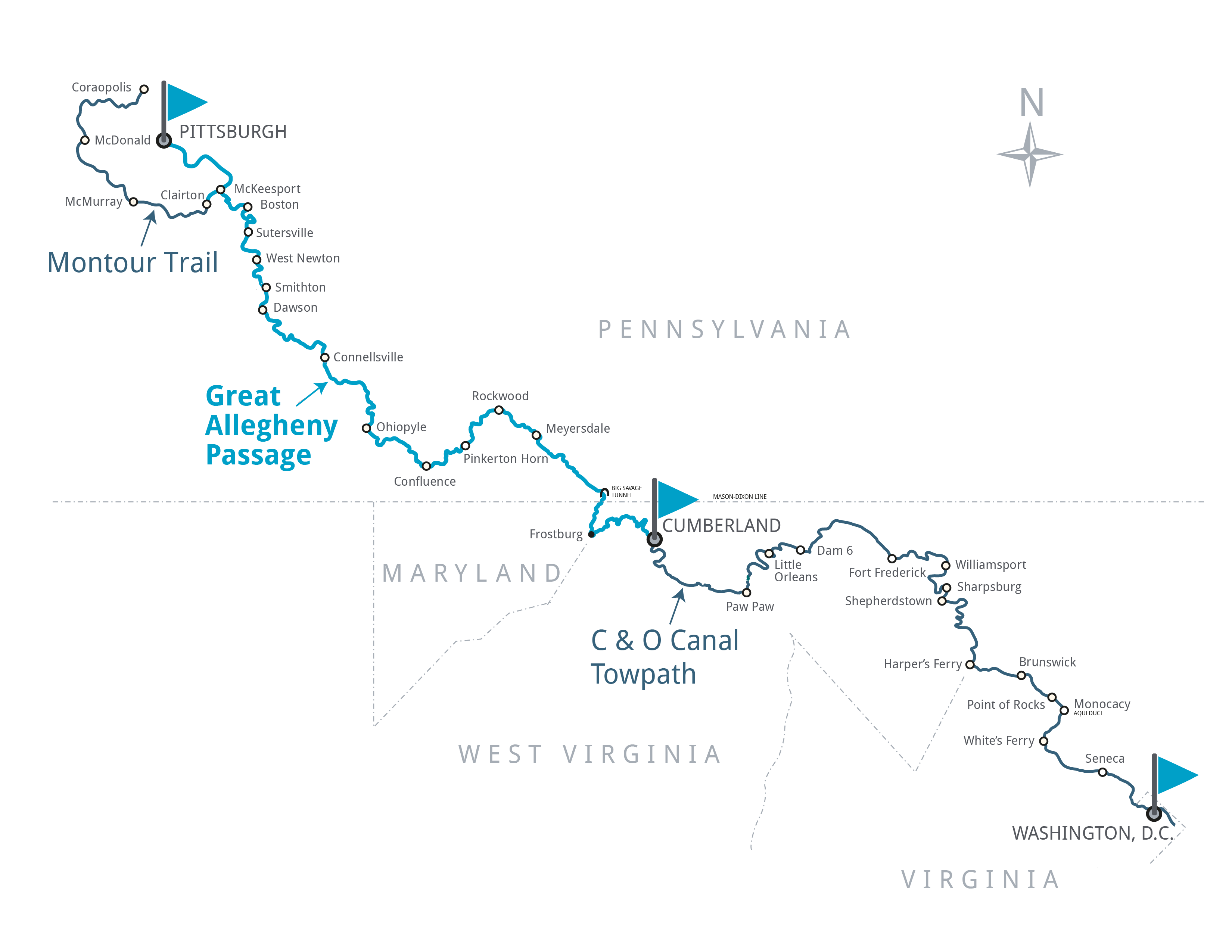
The 150-mile Great Allegheny Passage soars over valleys, snakes around mountains, and skirts alongside three rivers (the Casselman, Youghiogheny, and Monongaleha) on its nearly level path. Cyclists pass through the Cumberland Narrows, cross the Mason-Dixon Line, top the Eastern Continental Divide at 2,392’, weave through the breathtaking Laurel Highlands, wind their way through 19,052-acre Ohiopyle State Park, journey through the region’s coke, coal, mining, and steel-making corridor, and end at Pittsburgh’s majestic Point State Park.

TRAIL INFORMATION
Destination Map